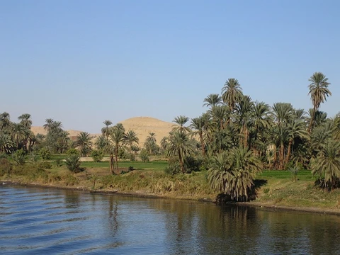
Yellow River
Cradle of Chinese civilization, source of devastating floods.

via Wikipedia: Yellow River · see source
The Yellow River, also known as Huanghe, is the second-longest river in China and the sixth-longest river system on Earth, with an estimated length of 5,464 km (3,395 mi) and a drainage basin of 795,000 km² (307,000 sq mi). Beginning in the Bayan Har Mountains, the river flows generally eastwards before entering the 1,500 km long Ordos Loop, which runs northeast at Gansu through the Ordos Plateau and turns east in Inner Mongolia. The river then turns sharply southwards to form the border between Shanxi and Shaanxi, turns eastwards at its confluence with the Wei River, and flows across the North China Plain before emptying into the Bohai Sea. The river is named for the yellow color of its water, which comes from the large amount of sediment discharged into the water as the river flows through the Loess Plateau.
- length
- 5,464 km (3,395 mi)
- drainage_basin
- 795,000 km² (307,000 sq mi)
- source
- Bayan Har Mountains
- mouth
- Bohai Sea
- basin_population
- 120 million
- nicknames
- China's Pride and China's Sorrow
Verified Timeline
Lore & Background
The Yellow River basin was the birthplace of ancient Chinese civilization. According to traditional Chinese historiography, the Xia dynasty originated on its banks around 2100 BC; Sima Qian's Shiji (c. 91 BC) record that the Xia were founded after the tribes around the Yellow River united to combat the frequent floods in the area. The river has provided fertile soil for agriculture, but since then has flooded and changed course frequently, with one estimate counting 1,593 floods in the 2,540 years between 595 BC and 1946 AD. As such, the Yellow River has been considered a blessing and a curse throughout history, and has been nicknamed both 'China's Pride' and 'China's Sorrow'. In Chinese mythology, the giant Kua Fu drained the Yellow River and the Wei River to quench his burning thirst as he pursued the Sun. Historical documents from the Spring and Autumn period and Qin dynasty indicate that the Yellow River at that time flowed considerably north of its present course. During the era of the Three Sovereigns and Five Emperors (around the early 21st century BC), the Yellow River flooded repeatedly, and Yu the Great was ordered to control the waters. The Yu Gong records: 'Guiding the River from Jishi, it reached Longmen; southward to Huayin; eastward to Dizhu; then further east to Mengjin; passing east of Luorui, it reached Dapei; crossing north of Jiang River, it reached the Great Plain; then spreading northward into nine channels, they merged into the Inverse River and entered the sea.' This course is known as the 'Yu River.'
In the fifth year of the reign of King Ding of Zhou (602 BC), the river left these paths and shifted several hundred kilometers to the east. The Yellow River burst its banks and changed course at Suxu Mouth in Liyang, deviating from the original course of the Yu River. It then flowed into the sea at Zhangwu, marking the first major course change recorded since Yu the Great tamed the floods. Sabotage of dikes, canals, and reservoirs and deliberate flooding of rival states became a standard military tactic during the Warring States period. Major flooding in AD 11 is credited with the downfall of the short-lived Xin dynasty, and another flood in AD 70 returned the river north of Shandong on essentially its present course.
Reader's Guide
The Yellow River has long been critical to the development of northern China, and is regarded by scholars as a cradle of civilization. Flooding of the river has also caused much destruction, including multiple floods that have resulted in the deaths of over one million people. Among the deadliest were the 1344 Yellow River Flood, during the Yuan dynasty, the 1887 flood during the Qing dynasty which killed anywhere from 900,000 to 2 million people, and a Republic of China era 1931 flood (part of a massive number of floods that year that killed 1–4 million people). The cause of the floods is the large amount of fine-grained loess carried by the river from the Loess Plateau, which is continuously deposited along the bottom of its channel. The sedimentation causes natural dams to slowly accumulate. These subaqueous dams are unpredictable and generally undetectable. Eventually, the enormous amount of water needs to find a new way to the sea, forcing it to take the path of least resistance. When this happens, it bursts out across the flat North China Plain, sometimes taking a new channel and inundating most farmland, cities or towns in its path. The traditional Chinese response of building higher and higher levees along the banks sometimes also contributed to the severity of the floods: When flood water did break through the levees, it could no longer drain back into the river bed as it would after a normal flood, as the river bed was sometimes now higher than the surrounding countryside. These changes could cause the river's mouth to shift as much as 480 km (300 mi), sometimes reaching the ocean to the north of the Shandong Peninsula and sometimes to the south. Another historical source of devastating floods is the collapse of upstream ice dams in Inner Mongolia with an accompanying sudden release of vast quantities of impounded water. There have been 11 such major floods in the past century, each causing tremendous loss of life and property. Nowadays, explosives dropped from aircraft are used to break the ice dams before they become dangerous. The Yellow River's basin presently has a population of 120 million people, while over 420 million people live in the immediate provinces which rely on it as a water source. The basin comprises 13 percent of China's cultivated land area. The area receives uneven rainfall, only 2 percent of China's water runoff—water and sediment flow has decreased five-fold since the 1970s, and until recently, the river frequently did not reach the sea. Since 2003, China has been working on the South–North Water Transfer Project to alleviate the strain on the river's water supply.
Did You Know?
- The Yellow River is named for the yellow color of its water, which comes from the large amount of sediment discharged as the river flows through the Loess Plateau.
- According to Sima Qian's Shiji (c. 91 BC), the Xia dynasty was founded after tribes around the Yellow River united to combat frequent floods.
- One estimate counts 1,593 floods in the 2,540 years between 595 BC and 1946 AD.
- The river's mouth has shifted as much as 480 km (300 mi) due to floods and course changes.
- Since 2003, China has been working on the South–North Water Transfer Project to alleviate strain on the river's water supply.
Frequently Asked Questions
What is the Yellow River?
The Yellow River, also called Huanghe, is China's second-longest river and the sixth-longest river system on Earth, stretching roughly 5,464 km from the Bayan Har Mountains to the Bohai Sea.
Where does the Yellow River start and where does it empty?
It originates in the Bayan Har Mountains on the Tibetan Plateau and ultimately discharges into the Bohai Sea in northeastern China after a winding course that includes the famous 1,500 km Ordos Loop.
Why is the Yellow River nicknamed 'China's Sorrow'?
The river has a long history of catastrophic flooding and sudden course shifts that have devastated downstream communities, giving it that grim moniker alongside the more positive 'China's Pride.'
How long is the Yellow River and how big is its drainage basin?
It measures approximately 5,464 km (3,395 mi) in length and drains a basin of about 795,000 km² (307,000 sq mi), home to roughly 120 million people.
Why is the Yellow River called the cradle of Chinese civilization?
The fertile alluvial plains it deposited along its middle and lower course supported some of the earliest agricultural settlements in the region, making the basin the birthplace of one of the world's oldest continuous civilizations.
More in Rivers Of The World 1-20
Spotted an error? Know more?
This is a living reference — every entry is fact-audited, and reader corrections feed straight into our audit queue. Suggest an edit · See this site's audit record