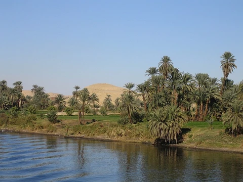
Mackenzie River
Longest river system in Canada, flowing into the Arctic Ocean.

via Wikipedia: Mackenzie River · see source
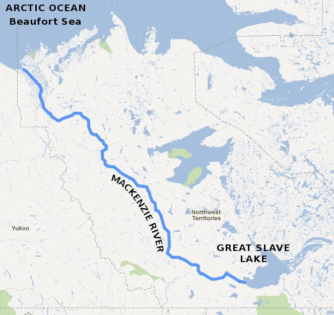
The Mackenzie River (Slavey: Deh-Cho, literally big river; Inuvialuktun: Kuukpak, literally great river) flows through the Canadian boreal forest and tundra, entirely within the Northwest Territories, though its many tributaries reach into five other Canadian provinces and territories. It forms, along with the Slave, Peace, and Finlay, the longest river system in Canada, the second largest drainage basin of any North American river after the Mississippi. The river's main stem is 1,738 kilometres (1,080 mi) long, flowing north-northwest from Great Slave Lake into the Arctic Ocean, where it forms a large delta at its mouth. Its extensive watershed drains about 20 percent of Canada. It is the largest river flowing into the Arctic from North America, and including its tributaries has a total length of 4,241 kilometres (2,635 mi), registering the 13th longest river system and 12th largest drainage basin on Earth.
- length_of_main_stem
- 1,738 kilometres (1,080 mi)
- total_system_length
- 4,241 kilometres (2,635 mi)
- drainage_basin_area
- 1,805,000 square kilometres (697,000 sq mi)
- ultimate_source
- Thutade Lake, Northern Interior of British Columbia
- mouth
- Beaufort Sea, Arctic Ocean
- largest_direct_tributary
- Liard River
- only_bridge_across_main_stem
- Deh Cho Bridge
Lore & Background
The ultimate source of the Mackenzie River is Thutade Lake, in the Northern Interior of British Columbia. The Mackenzie valley is believed to have been the path taken by prehistoric peoples during the initial human migration from Asia to North America over 10,000 years ago, despite sparse evidence. The Inuvialuit, Gwich'in and other Indigenous peoples lived along the river for thousands of years. The river provided the major route into Canada's northern interior for early European explorers. During the 19th century, fur trading became a lucrative business, but this was affected by harsh weather conditions. The discovery of oil at Norman Wells in the 1920s began a period of industrialization in the Mackenzie valley. Metallic minerals have been found along the eastern and southern edges of the basin; these include uranium, gold, lead, and zinc. Agriculture remains prevalent along the south, particularly in the Peace River area.
Reader's Guide
The Mackenzie River issues from the western end of Great Slave Lake about 150 kilometres (93 mi) south-west of Yellowknife. The channel is initially several kilometres wide but narrows to about 800 metres (2,600 ft) at Fort Providence. In 2012 the Deh Cho Bridge was completed at a point about 10 kilometres (6.2 mi) upstream, providing a safer permanent crossing—it is the only bridge across the main stem of the Mackenzie. At Fort Simpson it is joined by the Liard River, its biggest direct tributary, from the west. The river flows through open taiga bounded on the west by the Mackenzie Mountains and to the east by low hills of the Canadian Shield. At Norman Wells, a major centre of oil production, the Mackenzie widens considerably to about 6 to 7 kilometres (3.7 to 4.3 mi). About 30 kilometres (19 mi) northwest of Tsiigehtchic is Point Separation, the head of the vast Mackenzie River Delta, which spreads across more than 12,000 square kilometres (4,600 sq mi) of the coastal plain. The delta is nearly 210 kilometres (130 mi) from north to south, and is the second biggest Arctic delta in the world, after the Lena River delta in Russia. The delta contains a logjam with 400,000 caches of wood, which stores 3.4 million tons of carbon, equivalent to a year's emissions from 2.5 million cars. At 1,805,000 square kilometres (697,000 sq mi), the Mackenzie River drainage basin encompasses nearly 20 percent of Canada. Permafrost underlies about three-quarters of the watershed, reaching up to 100 metres (330 ft) deep in the Mackenzie Delta. Changes in climate and land cover of the basin are rapidly being reflected in its altered cryosphere and hydrology.
Did You Know?
- The Mackenzie River is the largest river flowing into the Arctic from North America.
- The Mackenzie Delta is the second biggest Arctic delta in the world, after the Lena River delta in Russia.
- The delta contains a logjam with 400,000 caches of wood, storing 3.4 million tons of carbon.
- The Deh Cho Bridge, completed in 2012, is the only bridge across the main stem of the Mackenzie.
- The Mackenzie valley is believed to have been the path taken by prehistoric peoples during the initial human migration from Asia to North America over 10,000 years ago.
Scale and Global Standing
The Mackenzie River stands as one of the most imposing waterways on the planet. Its main stem stretches 1,738 kilometres from Great Slave Lake to the Arctic Ocean, but when you trace the full network of tributaries—including the Slave, Peace, Finlay, Athabasca, and Liard—the total system reaches 4,241 kilometres, ranking it as the thirteenth longest river system on Earth. Its drainage basin is the twelfth largest globally and the second largest in North America after the Mississippi, swallowing roughly one-fifth of all of Canada. The basin's reach extends across five provinces and territories: British Columbia, Alberta, Saskatchewan, Yukon, and the Northwest Territories. Despite this staggering geographic footprint, the river flows almost entirely through the sparsely populated boreal forest and tundra of the Northwest Territories, emptying into the Arctic Ocean through a broad delta. It remains the largest river in North America that feeds directly into the Arctic.
Indigenous Roots and Ancient Passages
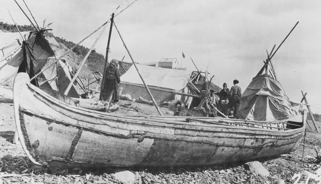
Long before European boots touched its banks, the Mackenzie valley was a living corridor for human movement. The river carries names that reflect deep Indigenous connection: Deh-Cho in Slavey, meaning big river, and Kuukpak in Inuvialuktun, meaning great river. The Inuvialuit, Gwich'in, and other Indigenous nations inhabited its shores for thousands of years, building entire cultures around its rhythms. Scholars believe the Mackenzie valley may have served as the route taken by prehistoric peoples during the initial migration from Asia into North America more than ten thousand years ago, though physical evidence for this remains sparse. For early European explorers arriving later, the waterway became the principal artery into Canada's northern interior, opening a path through a landscape that had been, until then, largely unknown to the outside world. The river thus sits at the intersection of some of humanity's oldest journeys and its most recent colonial encounters.
A River of Contrasts
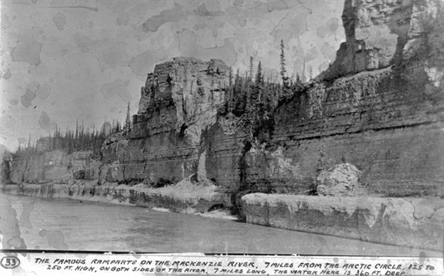
The Mackenzie's physical character shifts dramatically along its course. Emerging from the western end of Great Slave Lake about 150 kilometres southwest of Yellowknife, the channel is initially several kilometres wide before narrowing to roughly 800 metres at Fort Providence. West of there, it broadens into what resembles a shallow, swampy lake—Mills Lake being one notable widening. After a hundred kilometres westward, the river tightens again and accelerates through rapids past Jean Marie River. At Fort Simpson, the Liard River pours in from the west, carrying so much sediment during summer melt that its muddy water runs alongside the Mackenzie's clear current for nearly 500 kilometres. Further north, the river widens to six or seven kilometres at Norman Wells, then plunges six metres at the Sans Sault Rapids. The dramatic limestone gorge of The Ramparts—barely 500 metres wide yet up to 45 metres deep—marks another striking passage before the river crosses the Arctic Circle and fans out into its vast delta.
From Fur Posts to Oil Pumps
The economic story of the Mackenzie valley is one of slow, uneven industrialization. In the nineteenth century, fur trading became a profitable enterprise along the river, though harsh weather conditions constantly threatened operations. A more transformative shift came in the 1920s with the discovery of oil at Norman Wells, a point where the river widens to six or seven kilometres, launching a new era of industrial activity in the valley. The basin's eastern and southern edges have yielded metallic minerals including uranium, gold, lead, and zinc, while agriculture persists along the southern reaches, particularly in the Peace River area. Various tributaries and headwaters have been tapped for hydroelectric power generation, flood management, and irrigation. Yet despite these developments, economic activity along the river remains comparatively limited, a reflection of the vast, remote, and often inhospitable terrain that defines the landscape from the boreal forest to the tundra.
Gallery
Frequently Asked Questions
Who is Mackenzie River?
The Mackenzie River is a major waterway threading through Canada's boreal forest and tundra in the Northwest Territories. It anchors the longest river system in the country, with its drainage basin stretching across British Columbia, Alberta, Saskatchewan, and Yukon.
How long is Mackenzie River, and how big is its basin?
The main stem measures roughly 1,738 kilometres, but the full system—including the Slave, Peace, and Finlay—reaches about 4,241 kilometres. Its drainage basin spans approximately 1.8 million square kilometres, making it the second-largest river basin in North America behind only the Mississippi.
Where does Mackenzie River ultimately end up?
The river flows north-northwest out of Great Slave Lake and discharges into the Beaufort Sea, a portion of the Arctic Ocean. At its mouth it fans out into a broad delta where fresh water meets the cold Arctic expanse.
What is Mackenzie River's largest tributary and where does the system actually begin?
The Liard River is the Mackenzie's biggest direct tributary. The ultimate source of the entire system traces back to Thutade Lake in the Northern Interior of British Columbia.
Why is Mackenzie River important to the continent?
It constitutes the longest river system in Canada and drains the second-largest basin in North America, giving it outsized hydrological and ecological weight. Its reach across multiple provinces and territories makes it a defining natural feature of the northern landscape.
More in Rivers Of The World 1-20
Spotted an error? Know more?
This is a living reference — every entry is fact-audited, and reader corrections feed straight into our audit queue. Suggest an edit · See this site's audit record